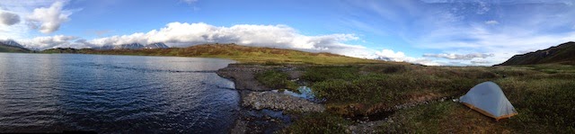
For hikers, the Skyline-Fuller lakes traverse is the Kenai Peninsula’s version of the Bermuda Triangle. Every person who has hiked it from the Skyline side knows the trail down from the final ridge to Upper Fuller Lake means bushwhacking. Usually way more than intended.
No more.
The Route
A Little Closer
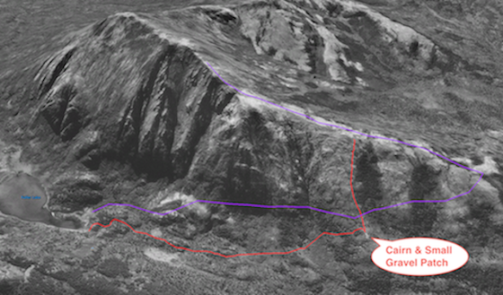
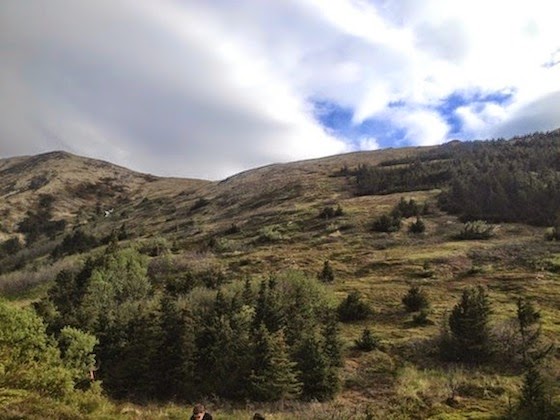
In the top figure, the purple line is the path shown on “the map”. (That trail is probably overgrown, and that may be something to explore on another trip.) The red line is the way off the ridge, down to a large cairn on a smaller ridge about 3/4ths the way down to the valley. The path from the cairn to the lake has been repeatedly flagged, and is a straightforward hike.
Getting Down
At the beginning of the red line on the ridge, on the trail itself is a small metal marker spray painted an unnatural fluorescent green. That marker has an attached aluminum plate, about the size of a playing card that reads:
TRAIL DOWN TO FULLER LAKE
START DOWN NOW
Do this. Start down the hill and look for flagging tape as you go. About 100 yards down the hill you should see another marker–identical to the first– on a small rise, that reads:
TRAIL TO FULLER LAKE LOOK
FOR PINK MARKER TAPE
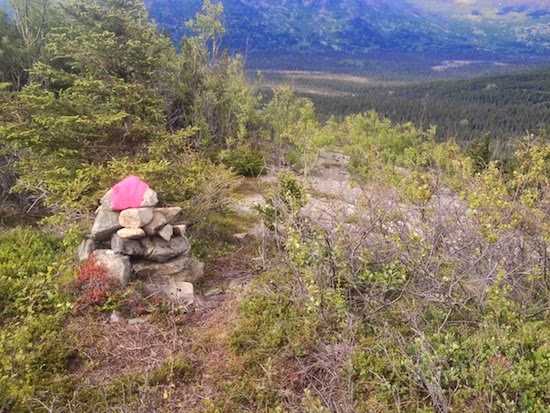
The Cairn
Looking Back up from the Cairn
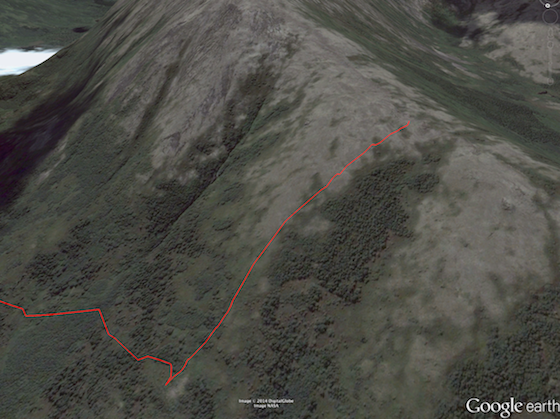
From that marker you should be able to follow the intermittent tape to the gravel patch and cairn. Alternately, the top rock of the cairn has been wrapped in pink flagging tape, which should be visible to sharp eyes, or a using a pair of binoculars, from the ridge. Also, note in the first figure the two banks of trees that form a U-shaped feature on the side of the ridge. Starting down before the first bank of trees, and keeping that to your left will lead you to the cairn, and out. Here is the GPS route as a Google Earth file: